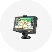
All categories
Featured selections
Trade Assurance
Buyer Central
Help Center
Get the app
Become a supplier

Galileo gps

(16640 products available)

About galileo gps

Types of Galileo GPS

The Galileo GPS was created to give a more accurate and reliable global satellite system for navigation and positioning. The Galileo system uses a satellite constellation, in which satellites communicate with ground stations to monitor their orbits and maintain precision signals. The number of satellites has increased since the initial launch, with plans for 30 satellites in total. As of now, 26 satellites are operational, with the remaining four planned for 2024. Today's Galileo GPS can be used worldwide and offers features like precise timing, navigation, augmentation systems, and search-and-rescue capabilities.

There are different kinds of Galilao GPS available for purchase:

  • Personal Galileo GPS: these GPS handheld devices may be used for leisure trailblazing, hiking, or railroad journeys. They are handheld gadgets with vivid displays that can create maps and offer directional guidance. These personal Galileo GPS gadgets are perfect for outside exercises because of their portability and ease of use.
  • Marine Galileo GPS: the marine GPS system is utilized for marine or aquatic purposes. Its primary function is to provide information about the ship's current location at sea and help seafarers determine routes to reach the shore or any other destination safely. The system comprises satellites, ground stations, and shipboard receivers. Skilled navigation personnel can plot the ship's course using charts and maps in conjunction with the GPS receiver's position data.
  • Galileo GPS for mobile devices: These may be smartphones or smart wearables. The GPS on mobile devices is usually integrated into the device, therefore, providing accurate location tracking and navigation services for users on the road.

Functions & features of the Galileo GPS

Galileo GPS is different from the traditional GPS because the GPS signals have a higher accuracy. The Galileo's free signal in space is worldwide and is available to civilian users. The Galileo system includes 30 satellites, of which 26 are operational and four are active. The Galileo receivers can determine the position faster than the traditional GPS.

  • Improved Accuracy

    The accuracy of which a user's location and time can be determined is improved in the Galileo system satellite. The European Union's Global Navigation Satellite System (GNSS) has its own independent system that provides accurate positioning.

  • Faster Time-to-First-Fix (TTFF)

    Galileo satellites work well with other GNSSs, such as GPS and GLONASS, by increasing satellite visibility in tough locations. The Time-to-First-Fix (TTFF) is the time it takes for the Galileo GNSS receiver to get a position fix when powered on.

  • Compatibility

    One benefit of having multiple GNSSs is that satellite signals from different systems can be used for positioning, navigation, and timing (PNT) in areas where satellite signals are obstructed or degraded, such as urban canyons and deep seas. Each GNSS follows its own signal standard, so all GNSSs' signals cannot be simultaneously used by a receiver. The Galileo GPS is based on the global standard.

  • Greater Reliability

    With access to more signals, the possibility of detecting a position, navigation, and timing (PNT) from satellite system is greatly enhanced. In critical situations, users can depend on the Galileo system for PNT. The Galileo system employs a systematic approach to improve GNSS integrity and a robust system to increase user safety.

  • Precise Timing

    The atomic clock compares the frequency of its oscillations with the standard definition of second oscillations. The Cesium atomic clocks in space give time in the Galileo system, with one billionth of a second accuracy. Timekeeping is important for knowing when a satellite signal was sent and for triangulating a position (using the time a signal from a satellite gets to a receiver). More accurate time will improve efforts to find a satellite's location.

  • Available in Dual and Multi-Band Receivers

    Global Navigation Satellite System (GNSS) receivers that use more than one satellite signal to calculate a user's position, such as in Dual and Multi-Band receivers, are becoming more popular. The more accurate positioning achieved through the improved performance Dual and Multi-Band receivers can help in critical applications where safety matters. These receivers use signals from different satellite systems to improve accuracy and reduce the time required for a position fix.

Applications of Galileo GPS

Compared to earlier systems, GNSS using Galileo GPS offers improved performance, higher accuracy, and robust positioning capabilities. Knowing the different applications of the Galileo GPS enriches the buyer with informed decisions when purchasing the equipment.

  • Aerospace and Aviation: Integrated GPS systems using Galileo play essential roles in flight operations, such as navigating commercial and military flights. They have increased the ability to control and improve airport operations and aircraft landing and takeoff procedures.
  • Automotive: Systems that integrate GPS using GNSS technologies have become popular in the mobility and automotive industries. They are essential for mapping, navigation, fleet management, driver assistance, and ride-hailing services.
  • Marine: Piloting, surveying, charting, and fishing in open seas and deep waters have been made possible and efficient through GPS systems that integrate GNSS. These systems have automated maritime operations and enhanced port and coastal management.
  • Emergency Response and Public Sector: Public agencies and emergency services use integrated GPS positioning to enhance their response capabilities in emergencies, disasters, and public safety. These systems enable real-time tracking of vehicles, assets, and personnel.
  • Rail Transportation: Integrated positioning systems are widely used in rail operations due to their efficient asset management, rail network development, planning, and rail line construction. Real-time tracking of trains has improved operational efficiency and safety.
  • Mining and Geophysical Applications: Integrated GPS systems using GNSS allow precise mining site surveying, exploration, asset tracking, and environmental monitoring. For mapping and other geophysical applications, integrated GPS positioning systems have enhanced environmental monitoring and exploration efforts.
  • Telecom: Integrated GPS systems using GNSS provide accurate time synchronization between telecom networks and mobile base stations. They ensure improved network performance, reliability, and location-based services. GNSS surveillance has enhanced time synchronization in telecom networks, improving their operational efficiency.

How to choose Galileo GPS

The global navigation system with satellites in orbit uses up to 30 satellites for a positioning system that can be used worldwide.

Although the number of satellites is less than in the GPS system, Galileo GPS is more accurate. In some countries, the Galileo system works together with the GPS system for added security in navigation and location finding.

The choosing criteria for a Galileo GPS tracker are listed as follows:

  • Target Market: Consider whether the GPS tracker will be sold to families, businesses, or specific industries (like logistics, field service, or emergency response).
  • Product Type: Most Google Maps GPS App or GPS devices can be divided into personal GPS trackers, vehicle trackers, fleet management systems, and asset trackers, among many options. Identify the type of product that best matches the target audience's needs.
  • Connectivity Type: Select which connectivity type best supports the use cases of the target market: cellular, Wi-Fi, Bluetooth, or satellite.
  • Galileo Support: Ensure that the GPS tracker fully supports the Galileo system. If the device can utilize signals from all the major GNSS systems (like GPS), it can enhance positioning accuracy if there are signal disruptions.
  • Accuracy and Precision: This device's seamless data transmission could be affected by various environmental factors (for example, urban canyons and high-rise buildings). Make sure the tracker has good accuracy and offers reliable performance.
  • Device Types: Different GPS tracking devices have other features and functionalities. Choose which is most suitable for the target audience: standalone personal trackers, vehicle tracking devices, fleet management systems, or asset trackers.
  • Integration & Compatibility: Account for existing systems and applications that the GPS tracking device can integrate with, such as fleet management software, logistics platforms, or mobile apps for end-users.
  • Data Management & Analytics: Consider how the location data collected by the GPS tracking device will be managed, stored, and analyzed. Evaluate the potential usecases for the data, such as optimizing routes, monitoring equipment, or improving safety.

Galileo GPS Q&A

Q1: Can the Galileo GPS work without the internet?

A1: Yes, the Galileo GPS can function without an internet connection. It receives signals from satellites and independently determines location, speed, and time. However, some Galileo GPS devices may require occasional internet access to download satellite data or firmware updates.

Q2: What is the difference between GPS and Galileo?

A2: Galileo is Global Navigation Satellite System. It works similarly to GPS by providing positioning, navigation, and timing services. Galileo uses signals from its own satellites. It is compatible with GPS so that receivers can use both systems simultaneously.

Q3: How accurate is a Galileo GPS?

A3: The accuracy of a GPS device that uses Galileo satellites can be up to 1 meter under open sky conditions. Factors like buildings, trees, or bad weather may affect accuracy. However, Galileo has a wide area augmentation system with more ground stations. This improves the accuracy and reliability of positioning services in many parts of the world.

Q4: Does a GPS with Galileo cost more?

A4: A GPS device that uses Galileo may cost a little more than one that uses only GPS. The price depends on the features, brand, and technology of the device. The added cost is usually not very high. But the better location accuracy and benefits make it worth the extra cost.